Seven Cascades (Tamarind Falls)
Seven Cascades (Tamarind Falls)
The Seven Cascades, or Tamarind Falls, offer a 3 to 4-hour hike in the highlands of western Mauritius, through dense forest, basaltic rock formations and natural pools.
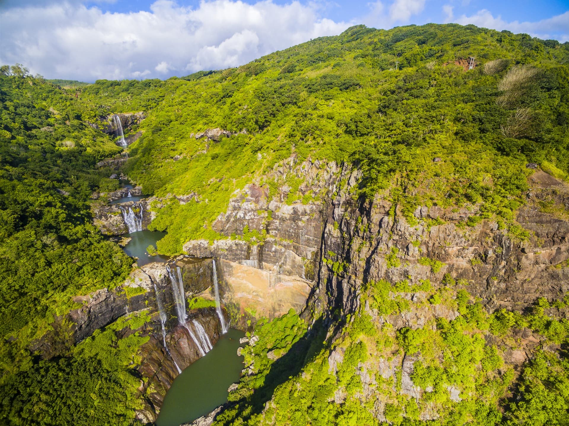
The Seven Cascades, also known as Tamarind Falls, are located in the highlands of western Mauritius, near Henrietta. This natural site features a series of tiered waterfalls along a river that tumbles down a forested plateau. Dense vegetation, volcanic rock formations and natural pools make it one of the island's most demanding hikes.
Practical Information at a Glance
- Access: the trailhead is located at Henrietta, accessible by car from Quatre Bornes or Vacoas.
- Duration: allow 3 to 4 hours for the full round trip, depending on your pace.
- What to wear: hiking boots are essential — the trail is slippery and rocky.
- Safety rules: swimming in certain pools is not recommended after heavy rainfall due to flash floods.
- Guidance: a local guide is highly recommended; the trail is not uniformly marked.
What You'll See
The Tamarin River descends in several tiers through a subtropical forest. You'll encounter waterfalls of varying heights, some accessible on foot, others visible from rocky vantage points. The basins carved into the basalt retain clear water between dry seasons. The canopy shelters endemic bird species and preserved indigenous vegetation.
History and Context
The name "Seven Cascades" is a local and tourist convention; the exact number of visible falls varies depending on water levels and the route taken. The Tamarin River originates on Mauritius's central plateau and has historically supplied water to the region's agricultural lands. The site remained largely unknown until it was integrated into organized hiking circuits.
Highlights of Your Visit
The Intermediate Pools
Halfway along the trail, several natural basins offer a welcome pause. The water here is refreshingly cool even during the austral summer. These spots are the most photographed and busiest on weekends.
Views Over the Plateau
As you climb toward the upper cascades, the forest canopy opens in places to reveal the central plateau and surrounding sugarcane fields. These clearings offer a striking contrast between wild vegetation and agricultural landscape.
The Main Cascade
The highest waterfall of the route plunges down a vertical basaltic wall. It's particularly spectacular during the rainy season (November to April), when water flow is at its peak.
Photography Tips
Morning light filters best through the canopy before 10 a.m. For long exposures of the cascades, a lightweight tripod is useful — flat rocks at the pool edges provide stable support. Avoid days of heavy rain: visibility drops and trails become hazardous. A polarizing filter reduces reflections on the water's surface.
Location and Access
The site is located in the highlands of western Mauritius, between Vacoas-Phoenix and the western coast. From Quatre Bornes, reach Henrietta via the B103 road. There is no direct public transport to the trailhead; car rental or a taxi are the most practical options. Local agencies offer guided excursions with transfers from west coast hotels.
Nearby Attractions
- Black River Gorges — national park with marked trails and endemic wildlife, about thirty minutes' drive away.
- Chamarel Coloured Earths — unique geological formation in ochre and red hues, accessible from the Chamarel road.
- Chamarel Waterfall — one of the island's highest falls, in a similar forested setting.
- Quatre Bornes — shopping hub nearby, a convenient starting point for supplies and accommodation.
Frequently asked questions
The dry season (May to October) offers more passable trails and reduced flood risk. During the rainy season, the cascades are more spectacular but slippery trails and sudden flash floods make hiking risky without an experienced guide.
The trail is not uniformly marked and some sections are technical. A local guide is highly recommended, especially for groups without tropical hiking experience.
Some intermediate pools allow swimming in the dry season. After heavy rain, water levels rise quickly and swimming becomes dangerous; follow your guide's advice.
Hiking boots with grip soles, lightweight but protective clothing to shield from vegetation, and a lightweight waterproof layer. Bring plenty of water for 3 to 4 hours of activity.
Yes. The Chamarel Coloured Earths and Chamarel Waterfall can be visited in the same half day by car. The Black River Gorges round out a full nature day in the western part of the island.
The complete hike is not recommended for young children due to rocky and slippery sections. The first pools, closer to the trailhead, remain accessible to accompanied children who are accustomed to walking on uneven terrain.
Interested in this visit?
We can include it in your personalised itinerary.